Big impacts in the ferry district
Published 2:00 pm Wednesday, September 19, 2007
The city releases a study of potential changes at the east end of Winslow Way.
Understanding the scope and implications of future growth in east Winslow isn’t the easiest reading.
The report was perhaps best summed up by Planning Commission Chairman Thomas Fischer.
“This is a monstrous report and I hesitate to encourage you to read it unless you’re an insomniac,” Fischer said. “But it will have significant impact on our island.”
The DEIS is more than 200 pages of analysis on the impact of proposed growth in the Ferry District, the Gateway District and Waterfront Park.
The area studied is roughly an upside-down “Y” shape defined by Waterfront Park at its southwestern edge, Ferncliff Avenue and the ferry terminal at its southeastern edge, and a narrow strip that extends up 305 and ends at Wallace Way just beyond the new Vineyard Lane development.
The report’s attention to detail outlines a fragile balance as planners proceed with the 2006 Draft Urban Design Plan/Winslow Master Plan, as part of overarching Winslow Tomorrow process.
The DEIS, prepared by Jones and Stokes environmental consultants, reviewed existing conditions of the environment, potential significant impacts, and mitigation measures for each element in the proposed growth area.
Those elements included: earth/soil, surface water and storm water drainage, plants and animals, land use, shorelines, visual quality, recreation, cultural resources and transportation.
Jones and Stokes prepared their analysis according to three growth alternatives that were presented last June to the Planning Commission. The range in development between the three options is dramatic and, although it is highly unlikely any of the plans will occur wholesale, it gives a rough estimate of what Winslow could look like in the near future.
The first assessment took stock of the “No Action” alternative which is slightly misleading because it incorporates potential developments under the current Comprehensive Plan policies and zoning regulations.
These potential developments could include the connection of Ericksen-Hildebrand, a police station renovation and space for a 40-room hotel/retail area near the current ferry parking lot.
Still, the “No Action” plan is viewed as one of the less-impacting alternatives. It maintains the Comprehensive Plan goal of concentrating 50 percent of population growth in Winslow up to the year 2012 which means an additional 475 housing units and nearly 14,500 square feet of commercial space could be accommodated in the Winslow Way East and 305 areas. This would have the impact of increased storm water runoff and pedestrian and vehicle traffic, which in turn affects the marine, wildlife and vegetation habitats.
Other alternatives studied would require Comprehensive Plan amendments and zoning changes and could see some major facilities built.
Alternative two provides open space on a five-acre, privately owned parcel just north of Harbor Square as well as increased trails for the public. It decreases the amount of potential residential development to 404 units, but this is offset by an increased retail, office and government building presence.
The third, and most radically transformative alternative, would see up to 1,253 residential units, 32,070 square feet of retail space and 45,194 square feet of office space. It calls for the relocation of the police station to make way for new developments and also proposes a vehicle connection from Waterfront Park to the Washington State Ferries shipyard.
There are plans to modify Waterfront Park under all three schemes. Plans two and three also account for the possibility of boating docks and improved water access due to increased density and pedestrian traffic.
One point that was avoided in the DEIS was the Washington State Ferries maintenance facility. The study may be key to influencing the currently stalled WSF plans to make their own environmental assessment prior to an overhaul of the ferry terminal.
Kathy Cook, the Winslow Tomorrow manager, said completion of the DEIS in December will put WSF in a position where “their plans will essentially respond to our plans.”
The release of the DEIS initiated at two-month comment period. It may take some time for citizens to weed through the document.
“People really need to digest this document,” Cook said. “That 60-day period really gives them that time to review.”
*************
Heavy reading
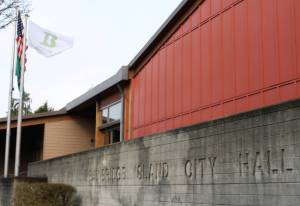
Copies of the DEIS are available at the Bainbridge Island Public Library. You can also view or buy a copy (paper or disk) at City Hall for the price of $54.
Study sessions regarding the DEIS will take place Sept. 27 and Oct. 11 followed by a public hearing on Oct. 25.