Bainbridge officials offer new look at controversial 305 bridge
Published 3:30 pm Friday, December 29, 2017
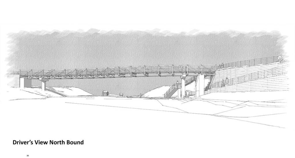
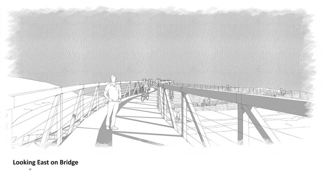


City officials have unveiled two new artist sketches of the controversial bicycle/pedestrian bridge over Highway 305.
The two new views of the “curved truss” structure will be presented to the Bainbridge Island City Council at its first meeting of 2018 along with an extensive presentation by city officials on why the bridge should be built.
The fate of the proposed $3 million bridge remains in doubt, however.
Three new council members will take positions on the council in January, and all three have vowed to cancel the bridge project.
With some opposition already existing to the proposed 305 bridge on the council, continuation of the bridge project is in jeopardy.
Opposition to the bridge runs deep in the Bainbridge community, as well.
Critics have dubbed the proposed span the “Bridge to Nowhere,” and many residents have said the structure is not needed, and say the city’s portion of the costs — a total of $1 million ($640,000 for the design, and $207,000 toward the construction costs) — should be spent on roadside improvements for walkers and bikers.
The bridge will be discussed during the Tuesday, Jan. 2 council meeting.
City staff is expected to make a hard sell to the council to keep the project alive, and staff will be asking the council to advance the curved truss bridge to the 30 percent design stage.
City officials want to get 30 percent design approval of the bridge by March 2018, with a signed construction contract in hand by early 2019.
Officials say the bridge is needed for walkers to cross a “superblock” of Highway 305 that stretches for .8 of a mile between Winslow Way to High School Road.
That distance, according to staff, is 4,224 feet, or equivalent to 14 blocks in downtown Seattle.
According to the presentation prepared for the council, city staff are now calling the proposed span the “Bridge to Everywhere,” and say it will help connect dense residential neighborhoods on both sides of Highway 305, and create a needed connection for people heading to retail stores for shopping or groceries, or walking to schools, the library and churches, and commuters heading to the ferry terminal.
For the first time next week, city officials will give an estimate of how many people will use the new bridge.
According to the presentation package for the bridge, city officials predict that 57 walkers and 86 bicyclists will use the bridge on a daily basis, or a total of 143 daily users.
The estimate on the number of bikers and walkers using the bridge was based on 3,592 single- and multi-family homes, including homes permitted but not yet built,in the greater Winslow area.
In a recent city survey, the curved truss option for a bridge was the most popular, with 25 percent of respondents favoring that design among seven choices. The Cascadian design was second most popular, with 24 percent picking that option.
Many of those who participated in that survey, however, did not want to pick a favorite design option and said the project should be abandoned.
Wrote one respondent: “I prefer to have no bridge over 305 at this location. It does not offer enough return on the investment. I would much rather have the city to spend the money on improved bike lanes across the island. Currently bikes share the road on most roadways which is unsafe for children and older adults. Please make biking more safe on the island rather than waste a lot of money on a bridge that is not wanted by the community and serves very few users. It’s a huge waste of taxpayer money!”
Another added: “This is most definitely a bridge from Nowhere to Nowhere. All it really does is REMOVE bike traffic from Winslow, which seems counter to the plan. There are no bike routes leading to the area, anyone going to the ferry would be on the West side of 305 already or on Ferncliff. This project is UNNECESSARY.”
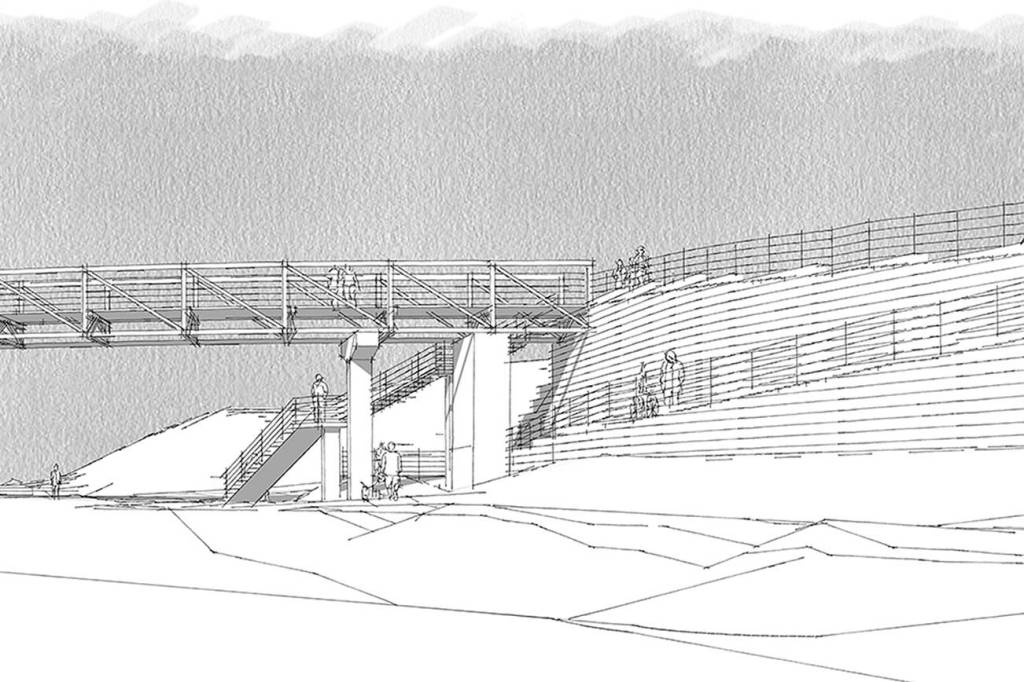
The latest drawings of the proposed bridge, with the curved truss design, vary significantly than the one shown in the recent citizens survey.
The new drawings show an additional, extended ramp to the bridge on its northeastern side.
Access from the top of the bridge to the Sound to Olympics Trail along the highway is depicted via a switchback-type trail and ramps on the southern end, and the eastern side of the bridge structure is notable for its staggered concrete retaining walls that rise from the grade of the highway up to the bottom of the bridge, a height of more than 17 feet.